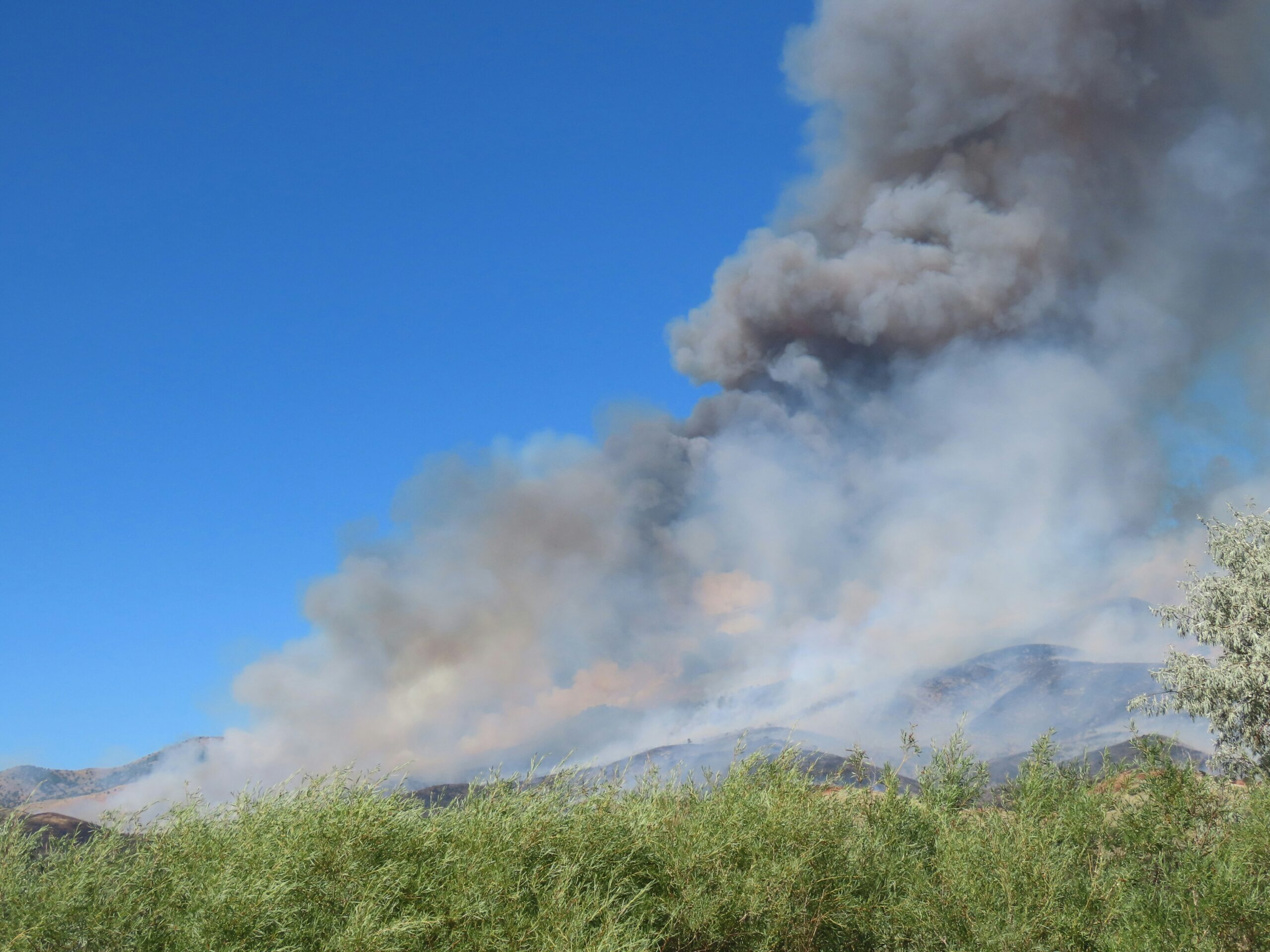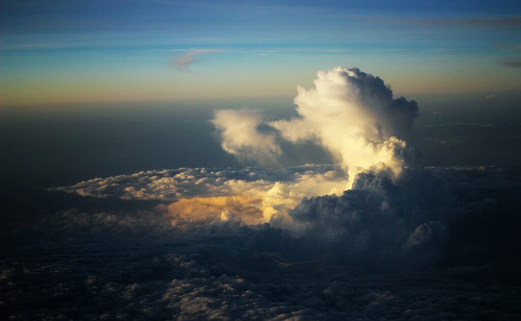
Pyrocumulonimbus clouds are among the most dramatic examples of fire interacting with the atmosphere. But how does an apparently ordinary smoke plume become a thunderstorm? The answer begins with a rising parcel of hot air – and depends as much on the atmosphere above the fire as on the fire itself.
During the recent fires in Gironde, southwest France, photographs showed a towering white cloud emerging from a darker column of smoke: a wildfire producing not just a plume, but deep convection capable of generating its own weather.
These clouds are known as Cumulus flammagenitus—commonly called pyrocumulus ( WMO International Cloud Atlas ) when they remain shallow, and pyrocumulonimbus – often shortened to pyroCb – when they develop into thunderstorms. They remain rare in Europe. Although hard to verify with certainty, the Gironde event may be among the first clearly documented examples in France.
Every fire produces a plume, but not every plume produces a cloud
A fire heats the air immediately above it. The air becomes less dense and rises, carrying smoke, gases and particles. Smoke is not itself a cloud. The brown or grey plume is dominated by gases and particles; the bright white part contains water droplets or ice crystals. Smoke particles can provide surfaces for condensation, but the plume must also contain enough moisture, rise far enough and remain buoyant.
This is why fire intensity alone cannot tell us whether a pyroCb will form. The vertical structure of temperature and humidity, atmospheric stability, wind and the amount of environmental air mixed into the plume all matter.
Reading the atmosphere with a tephigram
The thermodynamic diagram below provides a simplified view of the processes that lead to the formation of a fire cloud. The red line shows environmental temperature, the blue line dew point and the dashed black line an idealised rising parcel.
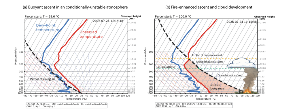
As unsaturated air rises, it expands and cools at approximately the dry-adiabatic rate: close to 9.8°C per kilometre. At the lifting condensation level, or LCL, the parcel becomes saturated and cloud droplets can form. Condensation releases latent heat, so the cloudy parcel subsequently cools more slowly, following a moist adiabat.
If the parcel is warmer than its surroundings, it is positively buoyant. The shaded area between the parcel and environmental curves represents this buoyancy. Ascent can continue to the equilibrium level, where the parcel is no longer warmer than the environment.
The left panel shows the ingredients for buoyant cloud growth. The right introduces a fire-heated parcel, whose initial thermal advantage may carry it through layers that an ordinary surface parcel could not penetrate. If condensation begins in an unstable atmosphere, latent heating can sustain deep convection.
How high can the plume rise before condensation?
This is where physics becomes slightly counter-intuitive. Making a parcel hotter does not necessarily make a cloud form closer to the ground. A very hot but unsaturated parcel may need to rise several kilometres before cooling enough to reach saturation.
A useful rule of thumb places cloud base roughly 125 metres higher for every degree Celsius separating parcel temperature from dew point. In a deliberately extreme example, air from a fire at 100°C with a dew point of 20°C has an 80°C dew-point depression, implying condensation only after roughly 10 kilometres of ascent.
The approximation becomes crude at extreme temperatures, and a fire plume is not a sealed parcel: it entrains environmental air and mixes with moisture released by combustion and vegetation. An effective mixed-plume temperature-dew-point difference of about 32°C would instead place condensation near 4 kilometres.
The environmental profile may be observed or forecast, but plume temperature and moisture are much more difficult to determine. The diagram therefore illustrates possible thermodynamic pathways; it is not a reconstruction of a specific fire.
This is, also, a highly idealised calculation that neglects turbulent mixing between the rising plume and its environment. In pyrocumulus and pyrocumulonimbus clouds, the vigorous updrafts generated by strong buoyancy may make this mixing particularly intense. Accurately representing turbulent entrainment and mixing in both ordinary convective clouds and fire-generated clouds remains a major challenge, even for today’s state-of-the-art global weather-forecasting models running at kilometre-scale resolution.
From pyrocumulus to pyrocumulonimbus
Once condensation begins, the outcome depends strongly on the atmosphere above. In a stable atmosphere, the cloud may flatten and dissipate. In an unstable atmosphere, the plume can grow rapidly through the troposphere, producing a deep pyrocumulus and eventually a pyroCb.
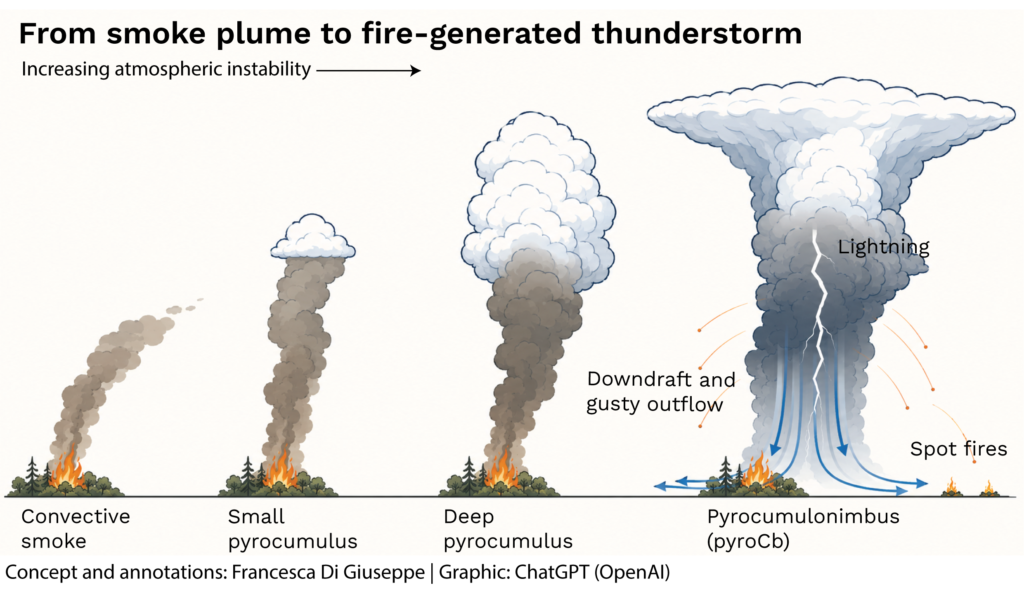
At this stage, fire and atmosphere become tightly coupled. Updraughts draw air towards the fire; downdraughts and outflow can cause abrupt changes in fire direction and spread. Embers may travel beyond the fire front, while ice formation can electrify the cloud and produce lightning. Despite their appearance, pyroCbs do not necessarily deliver substantial rain at the surface.
The largest events can carry smoke into the upper troposphere or lower stratosphere, at altitudes comparable to those reached by moderate volcanic eruptions. Once above most weather systems, smoke can travel over very long distances and remain in the atmosphere for months.
A rare phenomenon that we are only beginning to observe
The Gironde cloud is a reminder that extreme fire behaviour cannot always be understood as a surface process. Under the right conditions, a sufficiently intense fire interacts with the full depth of the atmosphere and becomes part of the weather system around it.
Direct measurements inside these events remain scarce. New field campaigns are comparing radiosondes in the surrounding atmosphere with instruments sampling the plume. These observations should help determine when a smoke column remains dry, forms cloud or escalates into a dangerous pyroCb.
For now, the most useful message is also the simplest: every fire creates rising air, but a fire cloud requires a particular combination of heat, moisture, mixing and atmospheric instability. The fire provides the trigger.
The atmosphere decides how far the cloud can grow.
Suggested scientific links
- Fromm, M. D., Servranckx, R., Peterson, D. A. & Stocks, B. J. (2022), Understanding the critical elements of the pyrocumulonimbus storm sparked by high-intensity wildland fire, Communications Earth & Environment.
- NASA Earth Observatory, Flying through a Fire Cloud.
About the authors
(Dr) Francesca Di Giuseppe is a meteorologist specialising in atmospheric processes and cloud–radiation interactions. She is also a wildfire scientist and has dedicated much of her scientific career to predicting the atmospheric conditions that lead to wildfires and influence their behaviour. Francesca is currently a Principal Scientist at the European Centre for Medium-Range Weather Forecasts (ECMWF) based in UK.(Dr) Adrian Tompkins is a meteorologist specialising in deep convection and large-scale atmospheric circulation. In recent years, his research has increasingly focused on the impacts of climate on human health. Adrian is currently a research scientist in the Earth System Physics at the Abdus Salam International Centre for Theoretical Physics (ICTP), a UNESCO Institute in Italy.